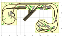
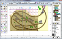
| This layout and drawing
demonstrate use of Cadrail 10's new Terrain Grids feature. The new tools
make it easy to specify elevations by clicking a grid square.
The drawing has Runrail all setup and running just turn it on and then go to
the 3d view for a fun in the cab ride.
Download CO 27 2a.exe (2.8 mb)
These
files require Cadrail Version
10 or the Cadrail 10 Demo to view and print.
How to use these
self-extracting files
| Note: this is a complex drawing with lots of detail.
The time needed to draw is dependant on the speed of your computer. These large files, take longer to draw
on the screen. |
|

3D View

Plan View

Terrain Grids
|